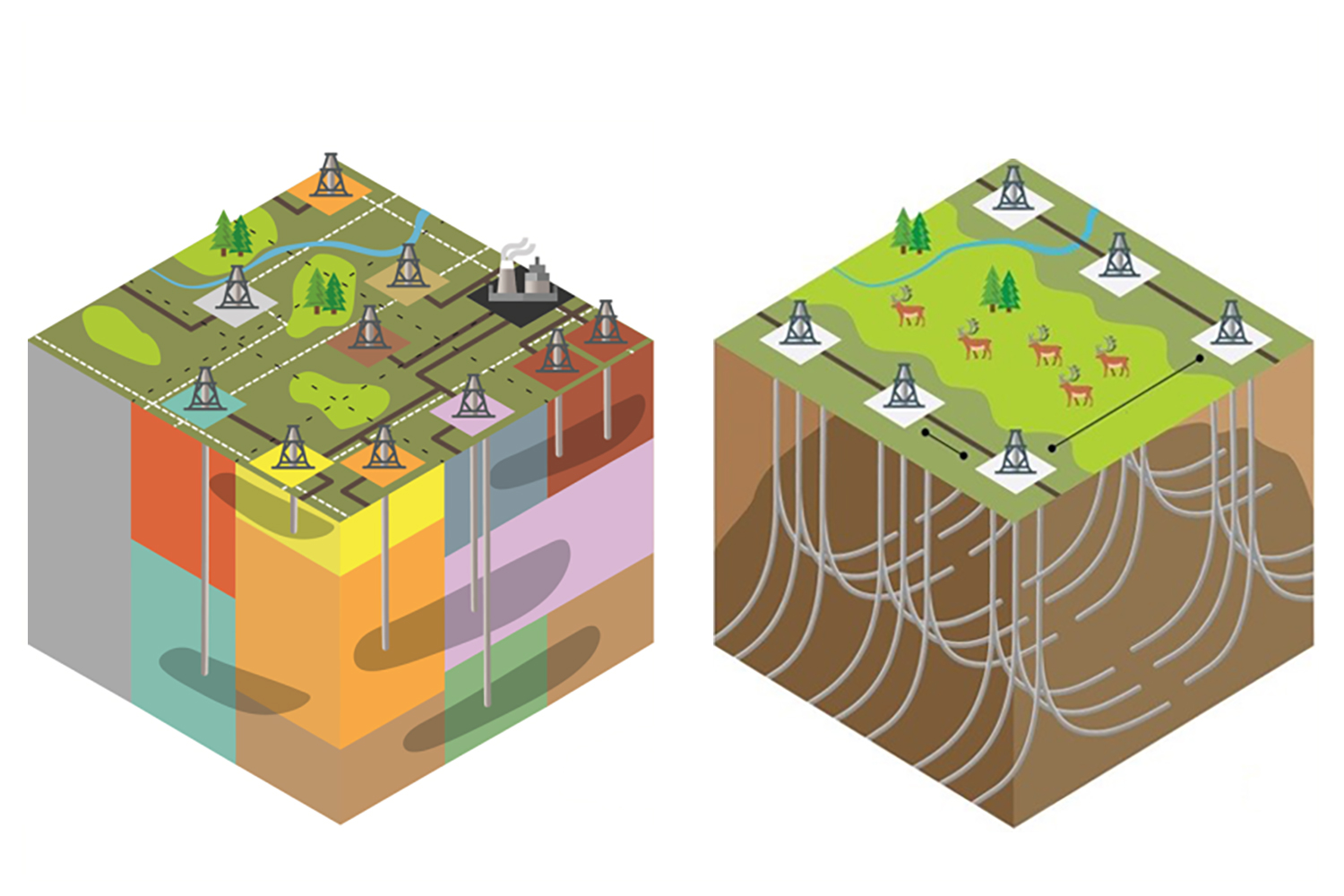


This project has been initiated to support the development of a regional access management plan (RAMP) through modeling potential access corridors under an integrated landscape approach and comparing the results to the current as-built network and previous regional access plans (RAD plan). Key indicators will be developed for assessing outcomes from access corridors for different audiences. The outcomes of this analysis will be used to develop a final regional access management plan supporting the caribou range plan requirements.
The intent of this project is to develop a transparent, repeatable, data-driven approach to reduce the overall impact to caribou from road corridor development. A phased approach was developed for this project beginning with a proof-concept-analysis and then scaling up to range level corridor analysis for the Little Smoky / A La Peche caribou range.
This report, prepared by Silvacom, discusses the process that was developed, the model framework, outcomes for the proof-of-concept analysis and the corridor analysis completed for the Little Smoky / A La Peche caribou range.
The project was co-sponsored by fRI Research and Government of Alberta with regular participation from an advisory group consisting of energy and forestry industry representatives from the Foothills Landscape Management Forum (FLMF) Industry Sub Group.
Gallery